


Tipo de sitio:
Rock-Shelter
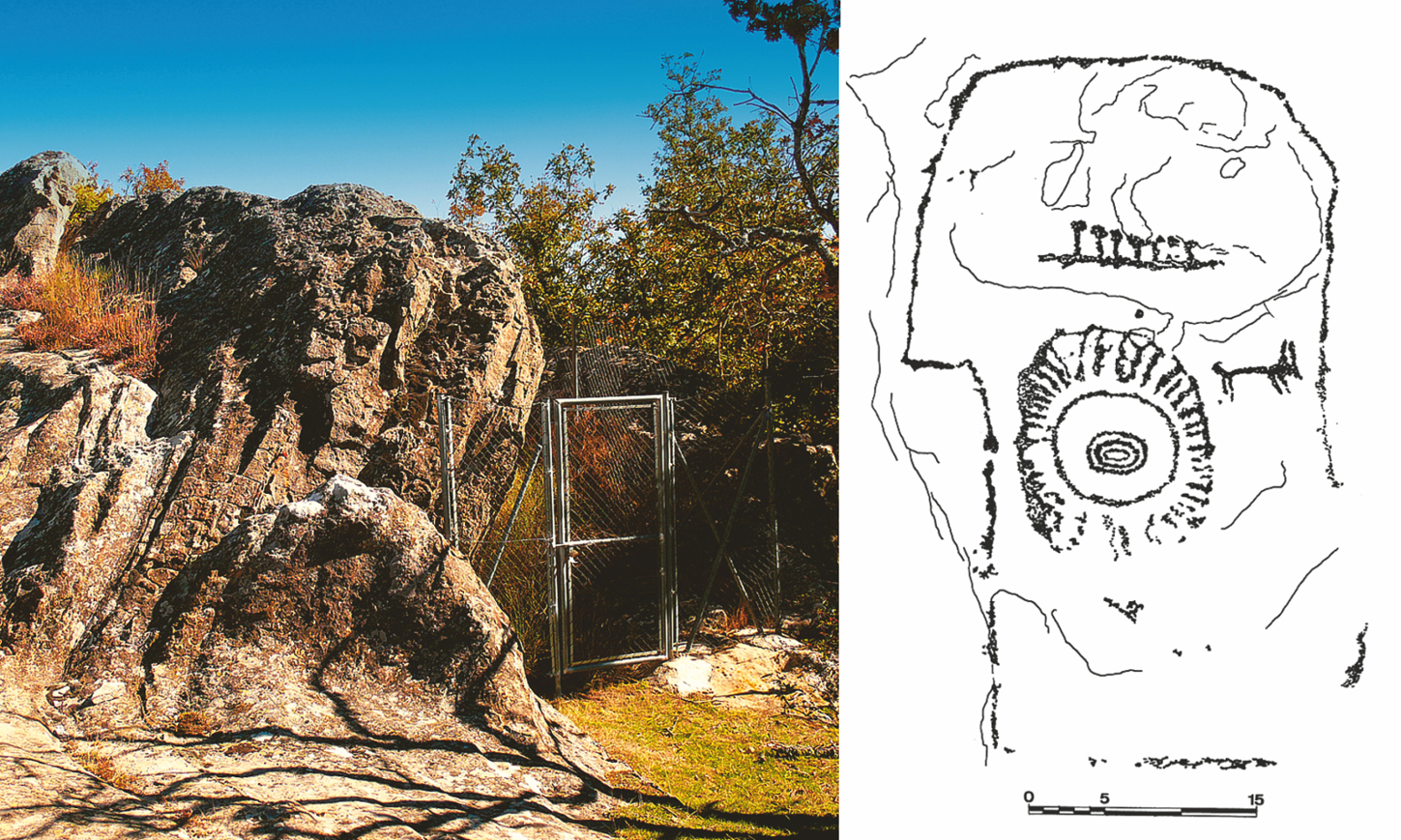
Lugar de localización: Peña los Plantíos
Localidad: Fuentetoba
Municipio: Golmayo (Soria)
Región: Castilla y León
País: España
Página Web: https://guiadesoria.es/patrimonio/monumentos-de-soria/657-fuentetoba-pena-de-los-plantios.html
Entorno Natural:
The site is in the Duero Valley, to the south of Pico Frentes at the end of Sierra de Cabrejas, where the land slopes gently towards the valley of the River Golmayo. The predominant vegetation is oak woods and grassland with sandstone outcrops.
Evidencias arqueológicas del sitio:
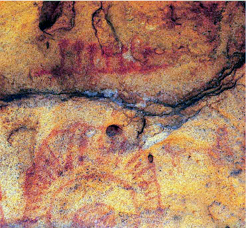
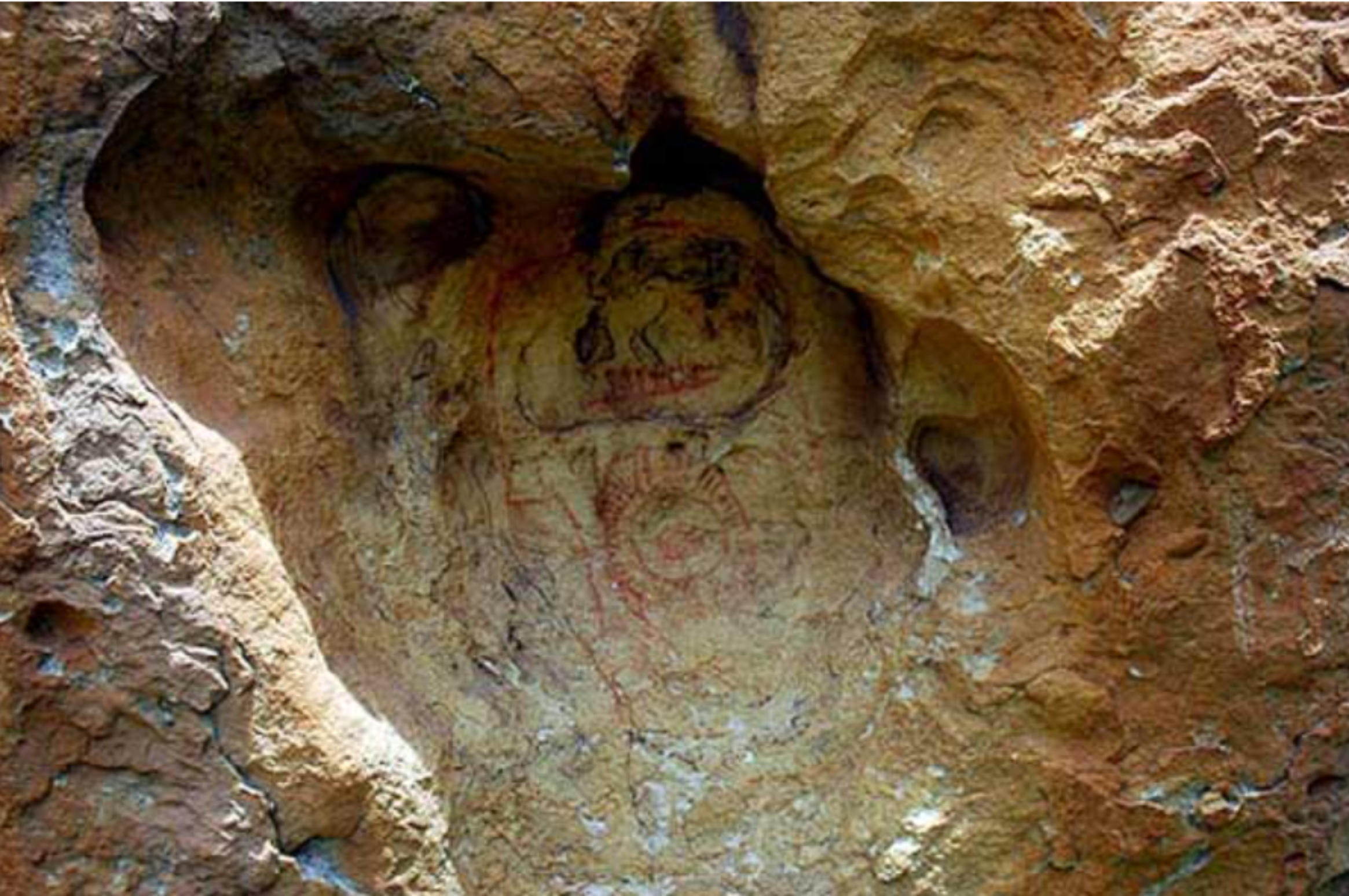
Located in the high Meseta of Soria, the site contains post-Palaeolithic Schematic art, which is found both in rock-shelters and in small hollows and caves. The representations at Peña los Plantíos are associated with nearby sites of the same type in neighbouring municipalities, like Prado de Santa Maria in Pedrajas, Cueva Larga and Cueva Grande in Oteruelos, and Monte Valonsadero in Soria.