


Type of site:
Rocky outcrops
Place of location: The mountain to the NE between Tivi and Nasirvaz villages, territory of Ordubad. A top of the Zangazur chains watershed.
Village/Town: Nasirvaz
Municipality: Ordubad (Nakhchivan Autonomous Republic)
Region: Ordubad
State: Azerbaijan
Telephone: (+994 50) 483 12 88
Website: http://gemiqaya.nakhchivan.az/ - https://www.nakhchivantravel.com/services/gemiqaya-tours/
E-mail: gemiqaya@nakhchivan.az
Natural Environment:
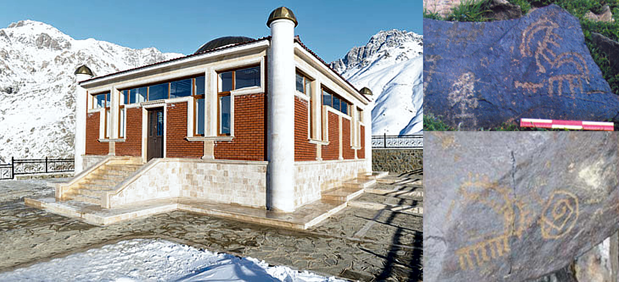
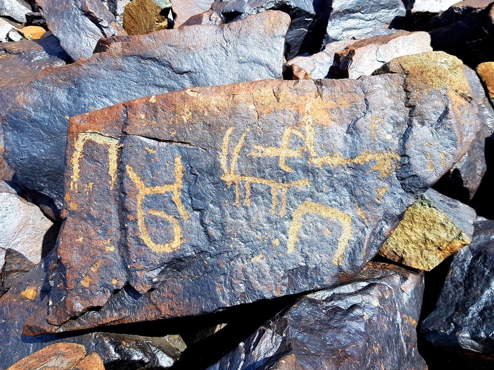
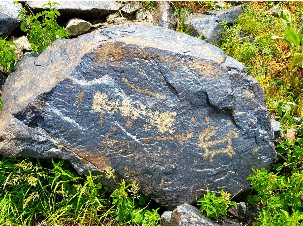
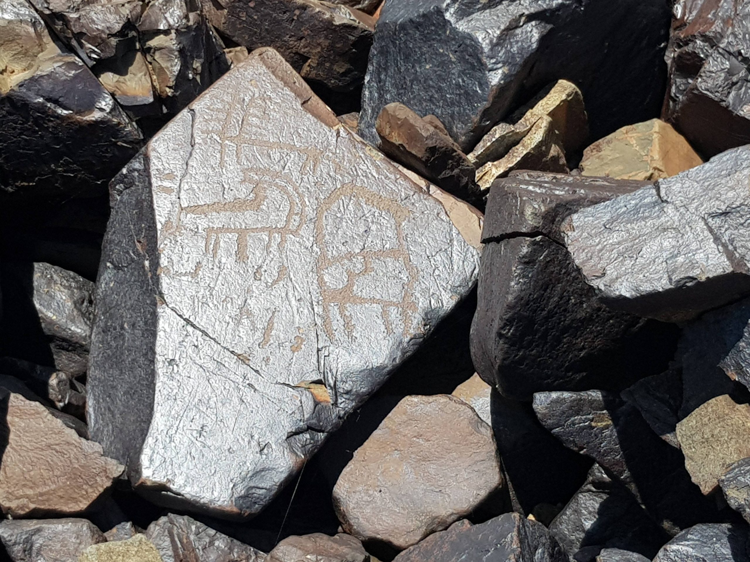
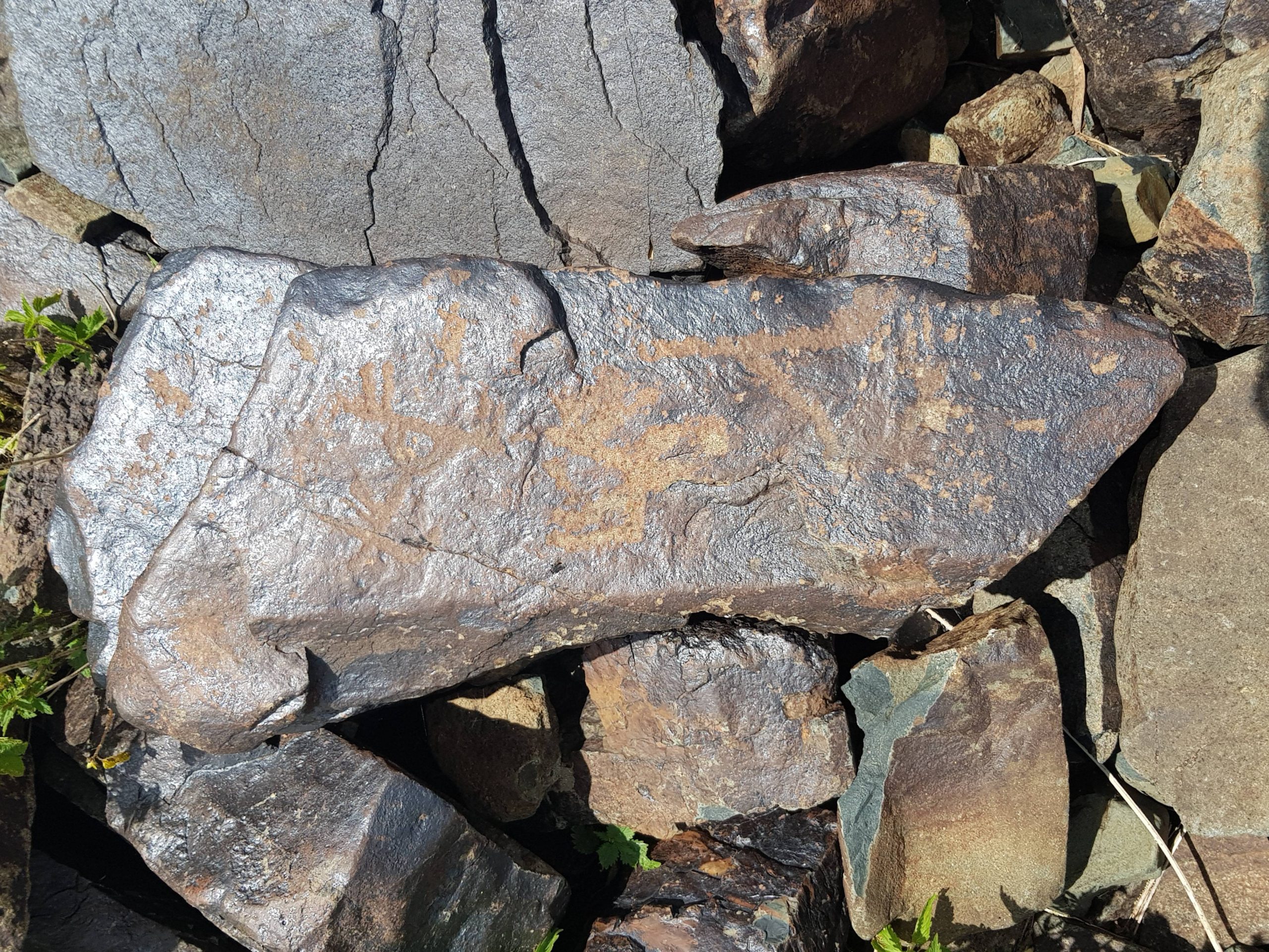
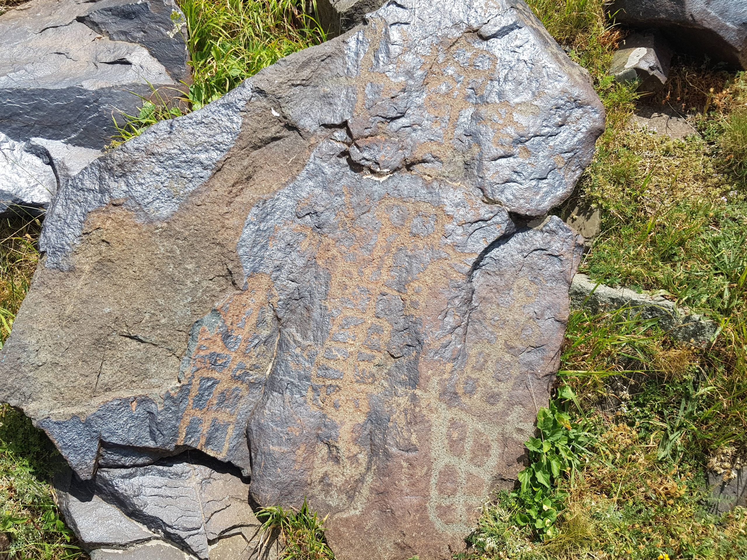
Gamigaya traceries are situated in southwest hills of Camisholan, Garangush flats in Gapijig peak, 3907 meter from the sea level (in Nakhchivan AR and in the territory of Ordubad district). The main area where the Gamigaya drawings are located is Garangush flat. The illustrations, which are located on gray and black parts of cliffs, are mainly in pink view. The locations of drawings are topographically very complicated. The on rock illustrations are in-group shape and they are mainly located on the nearby distance of water sources. We can encounter the likely groups in 5-6 places on the northeast part of Dali bulag. But there exist some illustrations, which go beyond the groups.
Archaeological evidences in the site:
Gami-Gaya Rock of Nakhchivan offers more than 1500 punched out and carved rock images, cemetery, necropolis, old settlements, graves, raft stones and plenty of caves and shelters of different periods.